r/geography • u/NormKramer • 2d ago
Discussion Is this all going to be developed sooner or later?
16
Upvotes
I hope not but looking at the directions of development between the two cities, it kind of looks like it.

r/geography • u/NormKramer • 2d ago
I hope not but looking at the directions of development between the two cities, it kind of looks like it.
r/geography • u/NicholeDaylinn1993 • 3d ago
I’m not necessarily looking for a place that’s overcast and foggy 24/7, like the Bay Area in California. I mean a city or region where the sunlight intensity or UV index isn’t as strong. Think of it as adjusting the brightness of the smartphone or laptop you’re using to possibly reply to this question. You don’t need the brightness at 100% maximum level, or completely dark at 0% where you can’t see the screen. You need it somewhere in the middle.
Are there any cities that fit this description? Where there is still regular sunlight, and not 200+ days of fog or overcast, or months at a time without direct sunlight, but the sun isn’t blaring down on you and burning your body up. Like the sun is shining frequently, but it’s just in the background of the sky where you can’t feel it. The brightness is there, but the heat and stickiness is completely absent.
Maybe a city with a mild climate, all 4 seasons, but no summer heat, no 90+ or 100+ degree F temperatures, and no heat intensity from the sun. Maybe a city with constant spring or fall weather for 8-9 months, then cold winter weather, then back to what it was before, with the sun still dimly shining in the sky background.
r/geography • u/VolkswagenPanda • 3d ago
Tamanrasset is a large city with over 100k people. The roads leading from it to the east north and south to Niger/Mali are all asphalted. The city itself has most of the services a city should have like running water, electricity, cars, etc.
However on the Malian and Nigerien side and even the Libyan side, there are a lot fewer people and almost no cities and paved roads.
r/geography • u/AdorableAardvark1061 • 3d ago
https://maps.app.goo.gl/GWZrUmzAxDx2HrW99?g_st=ic
(37.6817807, -119.8549487)
r/geography • u/Additional-Losss • 3d ago
Have you ever been absolutely stunned by the view or amazed how alien landscape looks like? Share
r/geography • u/MariSafari1 • 2d ago
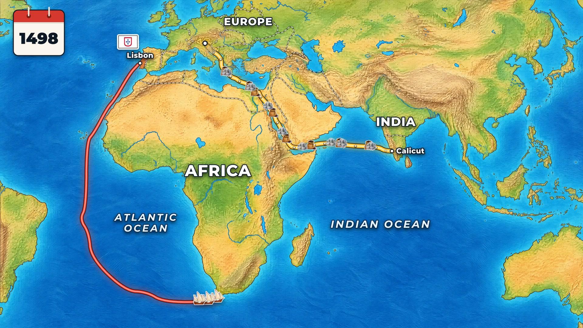
Made this while putting together an animated map explainer on how Venice lost the spice trade. The surprising part for me: Venice actually fought back and won the Alexandria route back by the 1560s — what finished it was the Dutch and English going round Africa in fleets after 1600. Sources: Lane 1940, O’Rourke & Williamson 2009, Braudel.
r/geography • u/mydriase • 3d ago
r/geography • u/RatioScripta • 3d ago
r/geography • u/KindMouse2274 • 4d ago
No major roads for miles, Very little population, And the tri-state border is rarely visited. I can only find a handful of photos of it online.
r/geography • u/MarsCoordinates • 4d ago
I built a free Chrome extension that fixes a quirk of Google Maps in mainland China. In satellite view, the roads and labels are about 500 m off the photos.
The cause is GCJ-02. Chinese law requires maps of the mainland to use it instead of WGS-84, and it shifts every point by a smooth but irregular 100–700 m offset that varies by location. Google draws its roads and labels using Chinese map data, so they're in GCJ-02, but its satellite photos aren't shifted. Around central Shanghai the roads sit about 480 m east-south-east of where they really are.
The before/after image is the Lujiazui district in Shanghai. On the left is Google Maps as it normally looks. On the right, with the extension on, the photos have been moved onto the roads.


Some details I found interesting while working on this:
- The offset formula leaked years ago and is widely re-implemented, but it has no closed-form inverse; you have to solve it iteratively.
- Hong Kong, Macau and Taiwan aren't shifted, so borders like Shenzhen–Hong Kong are where the two systems meet.
- Google itself serves pre-aligned imagery to users it thinks are in China. Everyone else sees them misaligned.
Privacy
It doesn't collect, store or send any of your data. The only thing it saves is the on/off switch, and the only extra requests it makes are for Google's own photo tiles, without your cookies.
Caveats
- It moves the photos onto the offset roads rather than the roads back to the truth, since labels, places, search and directions are all offset too. So the aligned map is still about 500 m from true GPS.
- A photo tile straddling a border can't be half-shifted, so there's a visible seam right on the line.
- Google's map data for mainland China is often years out of date anyway, so newer roads may be missing.
Here's the download link if you want to check it out
Happy to answer questions about GCJ-02 or how it works.
r/geography • u/manythings922 • 2d ago
Question for flat Earth believers: How does your map explain the route Japanese planes took from their carriers to Pearl Harbor—and the distances involved across the Pacific?
r/geography • u/sfgate • 4d ago
r/geography • u/One-Seat-4600 • 5d ago
r/geography • u/VolkswagenPanda • 3d ago
One interesting thing I noticed is that despite a good geographic location, there are some areas that remain significantly poorer than their neighbors with the 3 subdivisions in 3 different countries as good examples.
West Virginia is surrounded by more prosperous states and it's eastern tip is just a 2 hour drive from the DC metro area. In fact, only a 4 hour drive separated Mc Dowell and Loudoun counties, the poorest and richest counties in all of America.
Guizhou is located between Chongqing and the industrial cities in the Pearl Valley but remains one of China's poorest.
Pskov Oblast is located strategically between the 2 largest Russian cities, Moscow and St Petersburg, and wealthy EU cities like Tallinn and Riga but remain much less developed than both neighboring regions.
One thing all 3 share in common is the lack of major cities. Furthermore, both Guizhou and West Virginia are extremely mountainous.
r/geography • u/Vector_Bolt • 5d ago
r/geography • u/Cox_simps • 5d ago
r/geography • u/Anytimegetban • 5d ago
Main map: settlements with more than 25 households in Domesday Book
North-South dividing line defined by Danny Dorling, geography professor
+ UK's North/South divide according to multiple reddit posts

r/geography • u/jelani_an • 4d ago
r/geography • u/One-Seat-4600 • 6d ago
r/geography • u/2001_Arabian_Nights • 5d ago
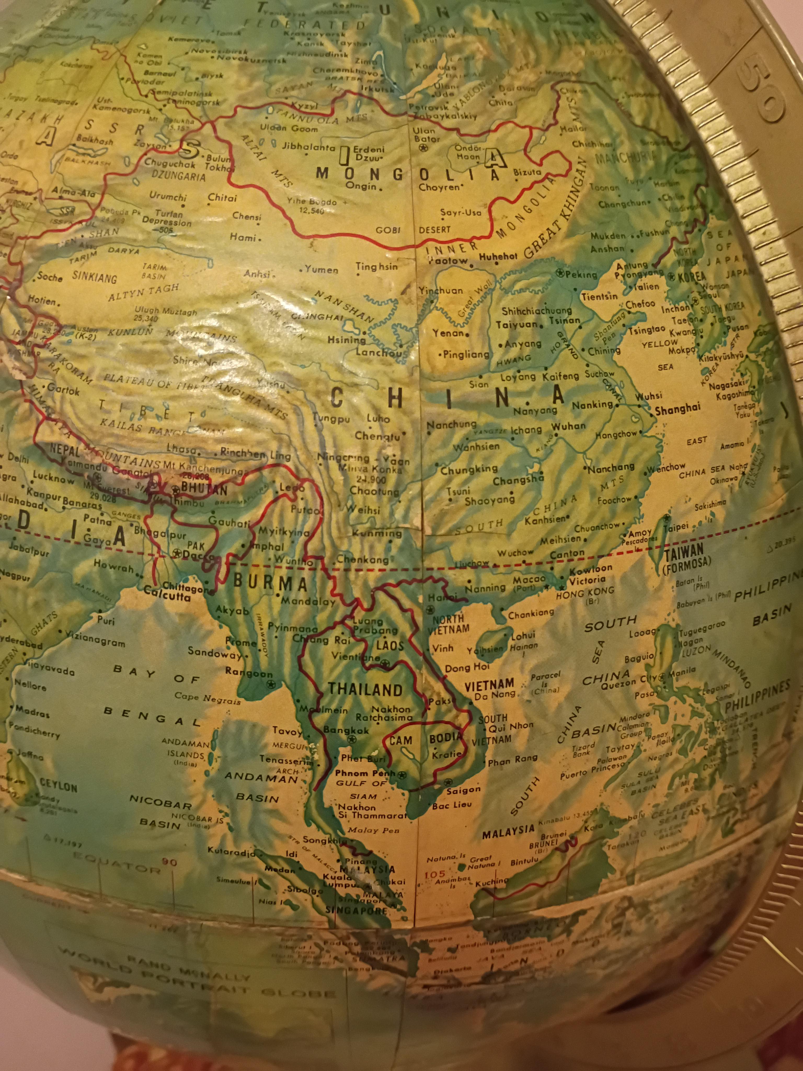
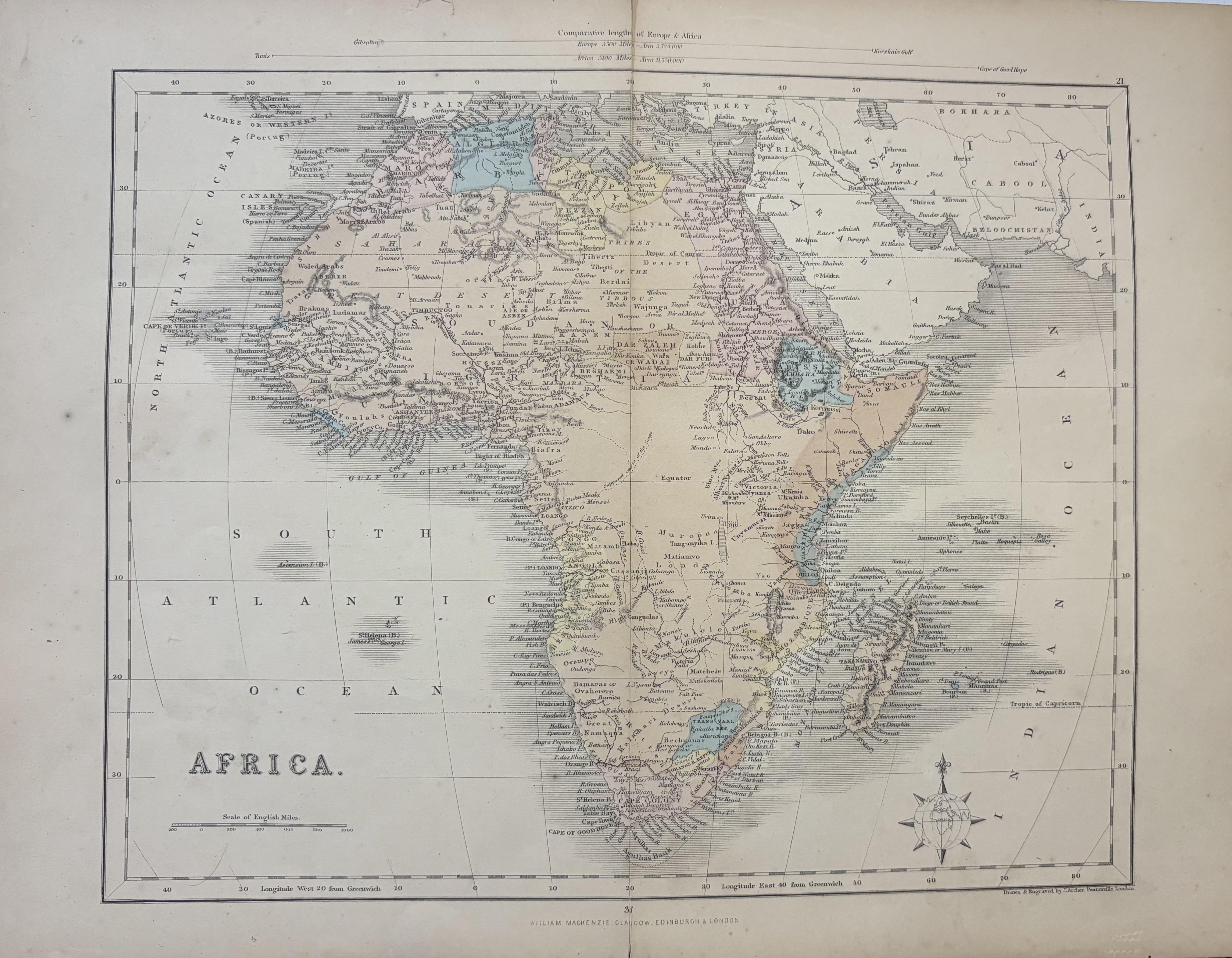
From my personal collection.
r/geography • u/2001_Arabian_Nights • 5d ago
I love archipelagos. I’ve never met one I didn’t like. There are a lot of varieties in a lot of different places, but which one do you find the most interesting?
Pictured - the Bijagós Archipelago off the coast of Guinea-Bissau.
r/geography • u/One-Seat-4600 • 6d ago
r/geography • u/VolkswagenPanda • 5d ago
Besides Dohuk and Suleymaniyah, Iraqi Kurdistan seems to include only parts of Nineveh and Diyala and most of Erbil. Also, why doesn't its borders follow rivers or mountains and it seems randomly drawn. Like the Tigris River seems like a good natural boundary.
It seems like it would be more fair if the Kurds got entire provinces instead of parts of multiple provinces. Like give them all of Erbil governorate, give them everything east of the Tigris River in Nineveh and have Duhok annex that part of the province and give up Diyala.
r/geography • u/JazzlikeTradition436 • 5d ago
I’ve just started a BA Geography Degree (UK) and I’m really enjoying it and finding it really interesting. Interested to hear how others are finding it so far.