The Herman beach is the highest shoreline of glacial Lake Agassiz. It's a gravel ridge the waves built when the lake stood at its highest level, about 11,700 years ago. Warren Upham described these upper beaches in 1879 and 1881 for the Minnesota Geological Survey, and he's the one who named the lake after Louis Agassiz.
At Muskoda the ridge splits the glacial hills above from the flat old lake floor below. A 1915 USGS guidebook to the Northern Pacific says the railroad dug a large gravel pit into the ridge here for ballast. Muskoda had a post office from 1873, a grain elevator and a potato warehouse. Then in 1909 the railroad moved its line, which left the town about half a mile off the tracks. The post office closed in 1930.
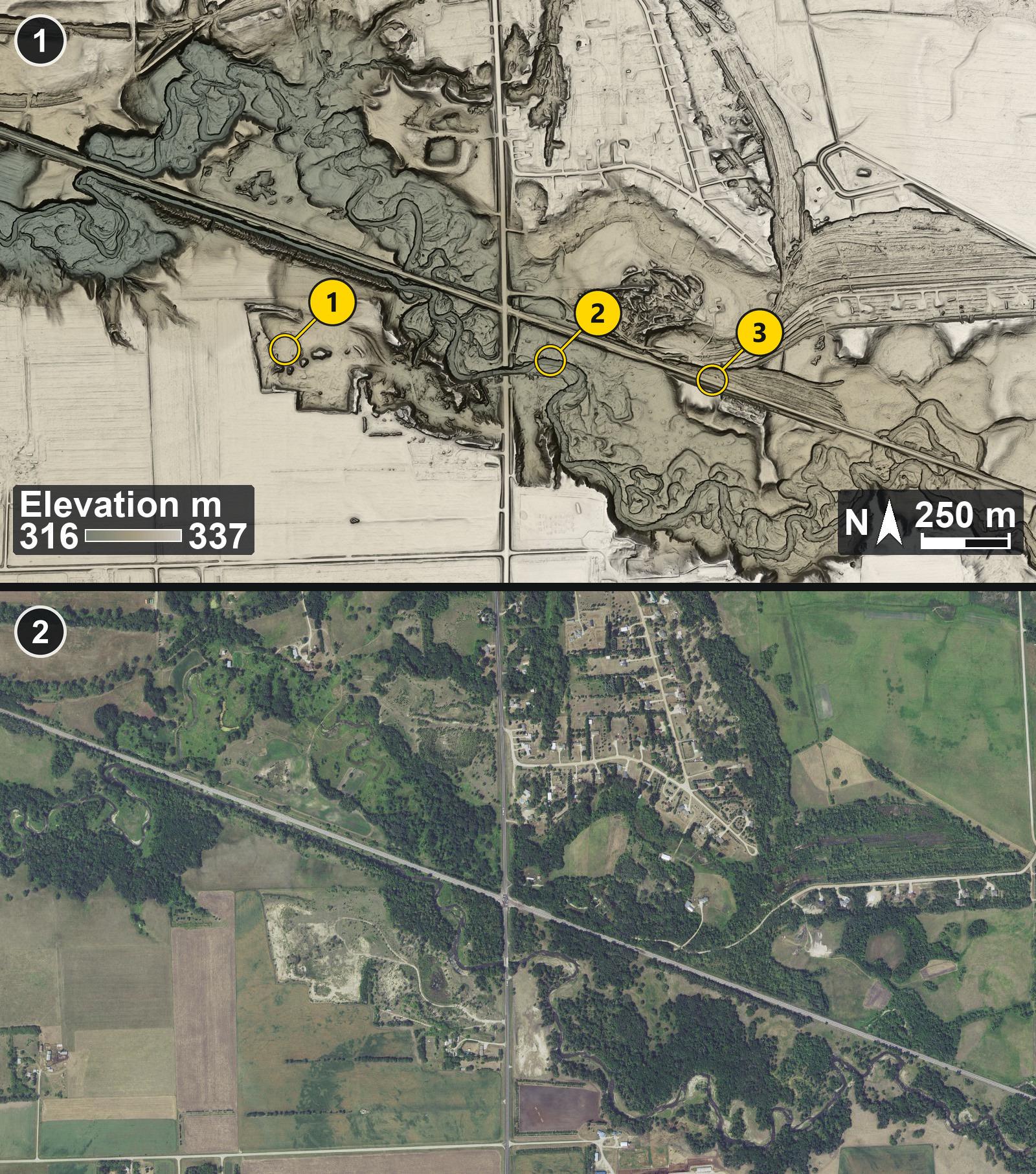
This is my own render of the bare-earth lidar. Just southwest of where the highway crosses the railroad there's a big flat-floored pit with steep squared-off edges, the sandy patch in the air photo. A stream winds across the view in a shallow valley.
1 (top): Bare-earth lidar at Muskoda, Minnesota, on Lake Agassiz's Herman beach
2 (bottom): Air photo of the same area, July 2021
Numbered pins on picture 1 (top):
Pin 1: Floor of the large gravel pit
Pin 2: A winding stream channel
Pin 3: The railroad line
Lidar: USGS 3D Elevation Program (3DEP), public domain.
Imagery: USGS The National Map (NAIP Imagery service), 2021, Public domain.